Thursday, November 26, 2009

Summer Geo-cache Treasure Hunt 2009

Summer Geo-cache Treasure Hunt


June 27th marked the Westmoreland Conservancy's summer Geo-cache event on our reserves. Geo-caching is a very popular phenomenon which allows participants to locate specific locations using their GPS units.

Conservancy member Tracee Imai attended our June meeting and gave a presentation explaining geocaching and its popularity. By posting this event on the geocaching.com website she was instrumental in introducing our reserves to participants from the South Hills, Butler and Armstrong County.

The picnic at Townsend Park's lower pavilion at 5pm was for all members and participants, and there were 47 people attending. Generous donations from Giant Eagle in Murrysville, Shop & Save in Holiday Park and GFS (Gordon Food Supply) of Monroeville combined with private donations to supply the picnic fare. Everyone pitched in to make the gathering special. Even a Grill-Master!

Once everyone had arrived for the picnic, some very special awards were given out. Many geocachers take their dogs along for the excursion, and this day was no exception. The participating pooches were allowed to come up and choose their own toy from the doggie treats provided by Petland of Monroeville. Then their people got to choose a bag of treats to pamper them even more.

As before, each participant was to sign the log book at each cache and take one (1) item from each location. Those managing to gather the items representing all locations received extra tickets for the drawings, which were held as soon as everyone had a chance to eat. Hoss's, Cosmos Pizza, Table 22, Atria's, Pasqualino's, Eat-n- Park, KFC, Chick-fil-a, Bella Luna, Pugliano's, Target, Monster Golf and Half-Price Books donated prizes (treasure) for our adventurers!

The Summer Geo-Cache Treasure Hunt was well-attended and lots of fun. We're looking forward to the Autumn Edition, coming up October 24, 2009. Watch our website for details.


Reserve Sign-Posting Parties, Winter 2009

Reserve Sign-Posting Parties. Mar 2009

We have been very fortunate to find appropriate boundary signs for our reserves. To celebrate this find we have been having sign-posting parties at the reserves. The first was held January 10th at the McGinnis Reserve. The weather was cold, there was freezing drizzle and the attendance was amazing! In just 3 hours the intrepid partygoers managed to post about 60% of the outside boundaries around the 52-acre reserve. The second round, held February 7th , completed the outside as well as the border around the 5-acre adjacent property.

March 7th and 14th focused on signing the Walter Reserve on Weistertown Rd. The Tomer Reserve is scheduled for March 28th , and the King/Potter Reserves are slated for April 18th and 25th at noon. We welcome anyone interested in helping out for a few hours. Contact us at the phone or e-mail listed in the newsletter header.

caught in the act
healing heart

Wednesday, November 25, 2009

Spruce Flats Bog/Laurel Summit 2008

Spruce Flats Bog/Laurel Summit

An Autumn Color Walk was held at Laurel Summit Trails on Saturday, October 11th, 2008. Some met at the Panera Bread in Murrysville at 9AM, while the rest of the group met at Laurel Summit. This will probably be the last time we schedule our Autumn outing to coincide with Ligonier Days, as the roads were backed up for miles in every direction

Located via the parking area in Laurel Summit State Park, a boardwalk beckons visitors from the forest right into the heart of the Bog.


Originally misnamed for the virgin stand of Hemlocks that covered this volcanic [or glacial depression] mountaintop, this 28 acre area boasts a most unusual ecosystem for this area. Back in the early 20th century, the hemlocks were lumbered out, followed by devastating fires, burning away the upper layers of organic matter leaving no vegetation to soak up the plentiful rainfall. The area is believed to be nestled in a bowl of volcanic rock, allowing years of vegetation to compost, promoting unusual species of plants to establish.

As this was my first visit, I can only share my observations without the seasonal comparisons. However, I can't imagine a more colorful and unique display.


As I soaked up the serenity of the Fall colors...earthy tan of the swamp grass and the greens of the evergreens surrounding the area… my eyes were directed to the subtle yet striking points of red dotting the landscape. Clumps of scarlet pitcher plants are many, as are blueberry bushes, which by the way, were loaded with the sweetest berries I've ever tasted. Large patches of sphagnum moss support cotton grass and tiny sundew and cranberry plants. These, as well as other species are more typically grown farther north.

If one is still long enough, the shy cedar waxwing can be observed swooping by to feed on swamp insects.


I have read that it is slowly evolving back to a mature forest, although I only observed a half dozen or so red cedars standing stoically in the mud.

There was evidence of human activity recently, as the area surrounding the boardwalk was quite disturbed. One has to wonder what is to be gained in disrupting the beauty and delicate nature of such an area.

It is, without a doubt, a must-see for anyone interested in yet another unique natural feature of this great state.

The original plan was to finish the excursion at Ligonier Days, however it was terribly crowded. Instead, several of our group headed down into Jennerstown and had a memorable lunch at The Green Gables Restaurant. The unique structure provided for interesting photos and the fare was top-notch. A walk on the grounds afterward allowed a glimpse of a kingfisher along the water’s edge.

Kate Blackmore

Spring Quarter Activities 2008

Saturday, May 31st: Rockland Furnace/Freedom Falls/McConnell’s Mills.

Westmoreland Conservancy will be participating in the Land Trust Alliance’s (LTA) Rally 2008 in September. In preparation for this event we put together a trial run of our field excursion, titled: Western PA Falls and Furnaces: Powerhouse of Historic Industry. Western Pennsylvania has long been a center of American Industry even before the modern Steel Mills. Our trip focuses on this historic past, beginning at Rockland Furnace (1860s) & Freedom Falls along the Allegheny River Trail in Rockland, PA. While there we also get to explore the ½ mile long Rockland Tunnel, a 1915 railroad tunnel now part of the Rails-to-Trails system.

After stopping for lunch we have a stop at Springfield Falls and the recently excavated Springfield Furnace before we head for Volant Mills. The 1812 Grain Mill in Amish Country has been converted to shops and has preserved machinery of the period on display for viewing.

Our final stop is McConnell’s Mills and a beautiful walk to Alpha Falls. The Grist Mill is situated above a lovely covered bridge and allows for great photo opportunities. This particular trip had a Great Blue Heron fishing (successfully!) for lunch. A nice conclusion to a great day!

Saturday, June 14th: Roaring Run/Apollo.

Sometimes Mother Nature changes our plans. Our group gathered on an overcast morning and headed out to Apollo and Roaring Run. After making the 1 ½ mile walk out to the foot bridge the skies opened up. This brought about a rather brisk hike back to the pavilion near the parking area.

As you walk along the trail there is evidence of beaver activity to be seen if you look for it. We even found some serious chewing on the picnic tables in the pavilion!

The steady rain brought our day to an early end, but it was enjoyable nonetheless.

Skena Parcel


A Parcel in Murrysville for Preservation
Dick Byers

I am amazed at how much development has taken place in Murrysville since I left eight years ago. Every time I drive the back roads when I’m in town, I see buildings that weren’t there on my previous visit. The amount of land left to be placed in the public trust is fast diminishing. People who moved here for Murrysville’s “rural character” are rapidly seeing it become more urbanized by the week.

There is a 21.6 acre parcel, zoned R2, which adjoins the Lillian Kellman Nature Reserve. This is the Skena Farm Estate that fronts on North Hills Road. The land includes a scenic pond, which forms the headwaters of the stream that runs through the Kellman Park property. A developer has made an offer to the Estate to purchase the property for $435,000.00. Some heirs of the Estate are trying to save the property from development; are working to obtain a one-year grace period, then came to the Westmoreland Conservancy’s November meeting requesting help. That is a hefty amount of money for our organization to raise in a year’s time and the board members were immediately stymied by the price tag. It is certainly well beyond the capacity of the Conservancy’s finances.

However, we shouldn’t write this off without first exploring our membership resources. After all, a similar amount of money was raised (when matching Government funds are counted) to buy the Kellman Farm in the 1990s. Perhaps there is someone out there with the experience in fund raising who also has the time and energy to handle the job. Never say it can’t be done. I have too often seen the impossible done before. Some years ago the Pennsylvania chapter of the Nature Conservancy sought to buy a small parcel of land in the southeast corner of the state that contained a pond that was home to the rare bog turtle. The price tag was $500,000. The seller agreed to sell it to the conservancy rather than a developer if they could come up with the money in a specified period of time. They took the challenge and, incredibly, they succeeded. They had everyone in the area involved, from local businessmen, schools, Lion and Kiwanis clubs, nature organizations, and the Boy & and Girl Scouts troops. They had bake sales, car washes, walkathons, birdathons, spaghetti dinners, flea markets, raffles and grant proposals. The stores in several towns had donation boxes on the counter. I remember an elementary school that raised $2000 – all for a turtle. That was about 20 years ago. Granted, they had a lot more time, but it shows what can be done if a group can get organized and set their mind to it. What it takes is an organizer who can devote a lot of hours and energy. I think the time limit, rather than the money is the biggest stumbling block and perhaps the best route to go would be for grant proposals, but even there we are just narrowly within the time required for foundation grants to get approved and processed.

Why should this land be saved? Fifty years ago no one would have blinked an eye had this property been developed. But 50 years ago there were 131 million less Americans, a lot more open space, and Murrysville was still rural. Aside from the fact that suburban green space is getting scarce, there are lots of other reasons for preserving this land. It will act as a natural buffer to the community owned Kellman Nature Reserve. The two properties would combine to form a 77-acre tract having a pond in the middle of town, close to local schools which have already used it in their education programs. It would allow more access to the Kellman Reserve from North Hills Road. There is room there for a parking lot in which buses could turn around. Keeping the land open means less population and traffic in Murrysville. One less housing development means less pressure on school classroom space, the hiring of more teachers, less pressure on the sewage system which has been constantly forced to expand, less snow removal and road repair required, etc. etc. Need I say more? I think most of our members know the advantages of open space over more sprawl.

If any person or persons would like to take on this challenge, please make your intentions known by contacting the Westmoreland Conservancy via email at contact@westmorelandconservancy.org or via regular mail at P.O. Box 446, Murrysville 15668 or by calling Clarence Skena directly at (724) 327-3656.

Update: (October 2009) Information was emailed by a board member of the Westmoreland Land Trust that the Skena parcel has been acquired by the Westmoreland Land Trust, and will shortly be turned over to the Municipality to become a complementary reserve to Kellman.

July 12, 2008, Buck Skena lead a 10 AM walk along the Skena Farm

Tuesday, November 24, 2009

Caywood: A Link Between MCP and King


Picture this: Park your car in the lot at the Walter Nature Reserve on Weistertown Rd. Follow the trail up and around to the meadow, then along the spur that connects to the MCP Trail in Murrysville Community Park. That trail will link to one taking you across the top of the Caywood Reserve, crossing Hills Church Road and passing through property owned by Dominion Gas. Follow the trail along the Shagbark right-of-way and into the King Reserve. Crossing Crowfoot Road takes you to the parking lot joining the King Reserve to Potter’s Corner. You have just traveled from the eastern edge of Murrysville to within a stone’s throw of Sardis Road and the Municipal Building without walking the high-traffic roads.

The Westmoreland Conservancy stands poised to make some pretty amazing strides as we enter 2009. We are going public with a key acquisition completing our first green corridor. The Caywood Property has been several years in planning (see below) and has opened wonderful possibilities for us. Included among them: a site-to-site trail proposed cooperatively through Conservancy and Municipal properties along this green corridor.

Along with property acquisition comes responsibility for creating safe trails, maintaining those trails and being good stewards of our properties. There are also many new expenses like surveying costs, subdivision costs, the expenses of creating parking areas as well as signs marking the property boundaries at proper intervals. We need to replenish our General Fund to accomplish these new tasks.

The work force has always been made up of volunteers from within the Conservancy. That’s one of the great things about being an organization with strong community ties. But as we grow, we need our active membership to grow as well. We are preserving the land you love, the land where your families grow and play. We need you to help us do that. To help us reach our goals we are having a FRIEND-AND-FUNDRAISING DRIVE beginning now, January 2009. The simple truth is that we need active members, we need new members, and we need money.


CAYWOOD: A LINK BETWEEN MCP AND KING
By Don Harrison

In the fall of 1995, John Oliver, President of the Western Pennsylvania Conservancy called Fred Shirland, Westmoreland Conservancy President, asking if we had any interest in two parcels of land in Murrysville that had been offered to WPC. Patricia Walter of Wilkins Township wanted to gift 29 acres of the family farm on Wiestertown Road as a nature reserve open to the public. Likewise, Marjorie Saco of Bethesda, MD wanted to insure that her 95 acre parcel of land between Murry Woods and the Crowfoot Gun Club was protected from development. We hiked around these properties for a few hours before deciding that we really ought to have an aerial over view. Fortunately, Fred had a friend in Delmont who owned an airplane. Our fly over revealed how undeveloped the land was between Hilty Road on the east and Townsend Park on the west. We noticed too how well the Walter and Saco properties lined up on an east/west axis with lots of open areas in between.

Although Westmoreland Conservancy's stated purpose is to acquire and preserve rural and rustic lands for the public good, some board members questioned the wisdom of shouldering the responsibilities of ownership and maintenance of land freely open to the public. After all, the conservancy had turned over its interest in the Kellman Nature Reserve to the municipality on the premise that it was better equipped to operate a public facility. In the end a motion passed unanimously to accept fee simple title to suitable land.

Walter Nature Reserve was our first and by far the easiest acquisition. Before the Westmoreland Conservancy became involved, William and Patricia Walter had an approved sub-division of their grandparent's farm. All we had to do was accept title to her gift. The Saco acquisition was another story.

Marjorie and her nephew had acquired all of the fractional shares in the farm property dating back several generations. Originally surveyed in 1879 and known as the South farm and later as the King farm, it had escaped subdivision probably because there were too many fractional owners to ever reach an agreement to sell. A title search established that Marjorie and her nephew were the sole owners of the 95 acre parcel. And a new survey showed that with some adjustment the boundary closed. Now the only problem was money. Marjorie felt she couldn't afford to gift her property out right but would sell it to us at a bargain price. We agreed on a sale price of $120,000 for property that was appraised at $240,000. With a grant from DCNR, the financial support of the community and the willingness of Scott Conservancy to be our strawman until our provisional 501(c)(3) status became permanent, we assumed ownership of the King Reserve.

Opportunities to acquire the Tomer, Flinn and McGinnis Reserves shifted attention away from the King/Walter axis for a few years. Acquisition of Potter's Corner comprising three buildable one-acre lots adjacent to the King Reserve on Crowfoot Road, rekindled our interest in the green corridor. As a young woman, Cary Bohl had ridden horse back on the Caywood property. She knew Jane Caywood and was comfortable in discussing our desire to acquire some of her property. Jane owned two parcels: a 35 acre plot containing her house and an adjacent 102 acre parcel located between King on the west and Walter Reserve on the east. Our interest in Caywood intensified with the acquisition of the Cline property for a Municipal Community Park. Suddenly a link up between Townsend Park to the west and Walter Nature Reserve to the east became achievable. We began negotiating with Jane in earnest. Then without warning, she died on April 13, 2005. Seemingly our case had failed before it had begun. But to our delight and surprise Jane had devised us a 34 acre plot from the 102 acre parcel. Now that she no longer needed her house on the 35 acre plot, we had an opportunity to switch it with the devise. This switch would give us a land bridge from MCP to within about 1600 feet of King. Acquisition of eight acres on the western end of the 102 acre parcel would give us access a public road and place us within 700 feet of the King Reserve. The court and the heirs approved the land switch and the heirs agreed to our acquisition of eight acres on the west end of the 102 acre parcel. And the municipality approved a three lot subdivision of the 102 acre parcel. Dominion Gas grave us permission to cross their property. Shagbark Grove Real Estate deeded us a right of way along the northern boundary of lot 10, finally closing the 700 feet gap between MCP and King.

Geo Cache Treasure Hunt 2008


Geo Cache Treasure Hunt

A light drizzle didn’t dampen the enthusiasm for the GeoCache Treasure Hunt, which was held Saturday, September 13th. Open to the public, this event provided the opportunity for participants to challenge their GPS skills by searching for hidden “caches” in each of five nature reserves in Murrysville; the King Nature Reserve on Crowfoot Road, the McGinnis Nature Reserve on Hunter Road, the Tomer Reserve on Twin Oaks, the Walter Reserve on Weistertown, and Potter’s Corner next to the King Reserve on Crowfoot. Coordinates for all of the caches were identified at the entrance to each reserve.

If they successfully located the caches, the treasure hunters were rewarded with a chip and an opportunity to sign their name in the cache’s log. A picnic followed the hunt where raffle tickets were exchanged for the cache chips and prizes awarded to the winning ticket holders. Some participants found every cache, entitling them to even more chances to win.

Generous sponsors of the event included Atrias, Bruschettas, Giant Eagle and Pasqualinos- all of Murrysville, Damons and Monster Golf of Monroeville, and Vincent’s Pizza Park in Plum Boro.

Cary Bohl

Most of you are aware that when you try something new, there are often “bugs” that need to be worked out, whether it’s a program or an event. This was no exception. The following is an account of working out that glitch.


GeoCache by Doug Bauman

The Westmoreland Conservancy recently hosted a Picnic and Geo-cache Treasure Hunt on Saturday, September 13th. The object was to find the caches at each reserve, then finish the day at our picnic at Townsend Park where prizes were awarded. Saturday morning the hunt began, there was 1 cache in each of the reserves: Tomer, McGinnis, King, Walter and Potter's Corner. I decided to give it a try, having never used a GPS device before, I was anxious to try.

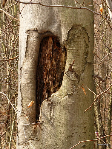
My friend Ladia and I decided to start early, and our first attempt was at the King reserve. We set up the coordinates in his GPS device, and proceeded to hike the path. This was fun, and we spent much of the time engrossed in interesting conversation, occasionally stopping to see if we were getting closer to the treasure. After a while we got to the top of the hill, and noticed that of the two coordinates, one was getting closer N40 27.520, yet the other was actually getting further away W79 39.965. Ladia wanted to turn around and proceed up the power line, yet I told him that would take us out of the King reserve and into a plan of homes. So we kept walking, hoping that at least one number would match up.

Soon we got to a place along the trail where indeed that one coordinate matched, yet the other was way off, but I happened to notice that the reading (39.020) was indeed about 1.0 away from the desired. Ladia and I, both engineers, decided to subtract 1.0 from the number, in the event that perhaps that one digit was transcribed incorrectly. So we reprogrammed 38.965, and voila, we were off into the woods thinking we had fixed the problem. Ladia was so anxious to go, that he led us off the trail and into the briars of the woods near the neighboring property of the rod and gun club. I didn't get a chance to tell him about the club, but luckily no shooting was heard this day. Soon I caught up with him and we kept going toward the direction indicated by the device.

I wore shorts, and my legs were suffering at the hands of the briars. Again we met up with the trail, where it bends to the left and toward the stone foundation. His device was not a top of the line model, and it seemed to have difficulty when you get close to the point you are searching. We wandered to the stone foundation, but no luck, nothing there, so we wandered all over that vicinity trying to locate the cache. After a while we started back, thinking that maybe we wouldn't be able to find it, but he wanted to go back one more time an we did. This time I was able to see the cache, just based on luck, because it was cleverly hidden behind a tree, yet right next tot he path, which I did not know a-priori. I told Ladia that we really ought to have stuck to the trail, ha!

On the way back we met up with a troop of scouts and their leaders and told them of the transcription error, to which they were grateful. The boys all seemed like they were having great fun, and they told us that the cache at Potter's corner was easily acquired. We next visited 3 more reserves and were readily able to locate the rest of the caches more easily. Ladia and I learned quite a bit about geo-cache treasure hunts and how to use GPS. It was fun, and we are looking forward to the next hunt!


RALLY 2008

RALLY 2008
The National Land Conservation Conference

Rally provides the opportunity for members of land trust organizations to come together and share ideas through seminars and workshops. It offers an in-depth program of conservation education and training. Robert Burger, Kate Blackmore and I led a field trip for The Westmoreland Conservancy on Thursday, September 18th, taking in Rockland Furnace, Freedom Falls, Volant Mills and McConnell’s Mill. The trip introduced participants to 18th Century Industry in Western PA. The Iron Furnaces and Mills pre-date the steel industry that Pittsburgh was so famous for in the 19th Century. Our group members came from Florida, Minnesota, Maryland, Colorado, Connecticut, California and Eastern PA.


Robert and I were able to attend Rally on behalf of the Westmoreland Conservancy. We attended workshops on Saturday and Sunday, and I was able to participate in the first Board Member Summit on Friday. The Summit allowed the attendees, all board members from land trusts all over the country, to discuss and find solutions to various issues. The information gathered and brought back to the Westmoreland Conservancy should keep us busy for quite some time!

Shelly Tichy

Rally Field Trip

A memorable day began at zero-dark-thirty as 23 of us, caffeine in hand, boarded a tour bus and headed North to the historic Rockland Iron Furnace (circa 1859). We found it nestled among mature hemlocks next to a peaceful waterfall. The day was cool and sunny, creating an atmosphere that filled the senses. Roberts' extensive knowledge of the era and area completed the experience.

From there we hiked down to the old Railroad Tunnel ( 1915). Two flashlights guided the group the half mile of darkness and back again to find the bus and healthy appetites awaiting us.

Due to the recent visit from Hurricane Ike the region was still experiencing some power outages which unfortunately included the restaurant we had reserved for lunch. However, an affiliate slightly farther away accommodated us nicely, and the food was superb.

Volant was on the schedule for the Amish experience, and the shopping, of course. The Grist Mill is presently under renovation and the water wheel adorns the front lawn of the building while the race is rebuilt. The shops are plentiful and full of wonderful crafts, antiques and reproductions.

We were all reluctant to leave Volant, but McConnell's Mill beckoned. Parked at the top, we walked down the lane thru the massive rock outcroppings. Robert, a geologist, is a font of information, and I think we all came away with a greater understanding of how the area came to be. We lingered as long as we could by the millstream, thru the covered bridge, and in the woods.

I believe that our guests had a taste of some of the best that Western Pennsylvania has to offer, and will hopefully take home with them that sense of home that we all feel when we explore this great state.

Kate Blackmore

Saturday, August 23rd: Murrysville Community Day

was held at the Public Works Complex on Sardis Rd. Tammy Frech from The Wildlife Center in Verona presented the Awesome Owls program at 3pm. She showed attendees an Eastern Screech, a Barred and a Great Horned Owl. For more program information, write to Tammy at: education@animalrescue.org

Flicker

The Flicker (a kind of woodpecker) is a frequent visitor to our nature reserves...

Murrysville Community Day 2007

Westmoreland Conservancy Display at
Murrysville Community Day 2007
by Mark Emerson

The 2007 Murrysville Community Day took place on Saturday, August 25th. Displays were set up at the Public Works municipal garage area near the municipal building. In addition an artwork show and plant displays were held in the Municipal Building itself over the same weekend.

The Conservancy display included a selection of invasive plants, a discussion by a wildlife rehabilitator, pass out information of a variety of Conservancy-related topics, and a display of photos and Maps showing Conservancy involvement and opportunities.

The Conservancy has joined a municipality-sponsored drive to rid, or at least control, the spread of invasive plant species in municipal parks. Although the accent is on public lands, private owners are encouraged to consider their own backyards as well. In order to more completely inform the public a sampling of actual plants was provided by Pia Van de Venne, the municipality's Coordinator of Park Volunteers. The display added some ‘reality’ to the vegetation that citizens may have been reading about but haven't really had the opportunity to see. Plants were provided with a name tag applied. More than once comments were heard like "Gee, I have that plant all over my backyard but didn't realize…" or "I know someone that actually bought that plant!".

Beth Shoaf, representing Wildlife Works, Inc., near Youngwood, brought along two box turtles (Doc and 3 Toes) and a corn snake, aptly named `Niblets'. She corn snakespoke for quite awhile on the subtle details of the reptiles, including their habitat range, food likes, and other information. She also gave a very interested group of visitors some insight into the specific life history of each of the animals on display. Her presentation was informal, generally a question and answer period.a visitor The animals were very well received, and discussions were held concerning her returning with additional specimens at a later date, perhaps next year.

Most of the photos were taken by Conservancy members. If other members have taken photos relevant to Conservancy activities and goals, and would like to share them, arrangements can be made to include some in next year's display


Not Every Visit to Our Reserves is an Organized 'Outing'

Not Every Visit to Our Reserves is an Organized 'Outing'
by Doug Bauman

tall mushroomThe other day I rode my bike around Murrysville. First I rode by the McGinnis Reserve on Hunter Drive. Then I rode down Wallace and down Twin Oaks Lane right by the Tomer Reserve. Twin Oaks Lane is one of my favorite places to ride. Then I rode up Mamont Road and via Steele and Hilty to Wiestertown, where I found a few chestnut seeds. They are just beginning to Chestnut on bed of goldenrodcome out of their jagged shells. Soon I was whizzing down the road toward the Walter Nature Reserve. I stopped there for a short visit. I visited the location of the grove of Paw Paw trees; every year I keep hoping, but I still have not been able to see any fruit up in that dense vegetation. Next to the path I observed some mushroom. I took out my camera and took a few pictures of the fungi in various lights, sun and shade. One mushroom looked like a creature from Star Wars! On my way back I rode by the King Nature Reserve off of Crowfoot. Well for me this was a short ride, one filled with joy with my desire to combine bicycling with observing and photographing nature!
Mushroom, The return of the ...

Photo Outings Autumn 2006

Linn Run


P.V. Park
PV Park

Autumn 2006 Photo Outings

Linn Run, Friday, October 13th

Fall colors, reflections of the Autumn foliage in the water, brisk, windblown leaves. The band of crazy photographers inducted a new member on the Linn Run outing October 13th. Mary Paulone Carns joined us on our all-day adventure, which was rather tame by previous standards (no one went into the frigid water this year!). After an exhilarating day (did I mention BRISK??) we followed Cary Bohl’s directions and had a late lunch at the Green Gables Restaurant in Jennerstown. What a spot! Quite a memorable day!

Pleasant Valley Park, Sunday, October 15th.

Next stop was here in our own Murrysville. We walked the new trails in Pleasant Valley Park with Douglas Granger in attendance! We thoroughly enjoy seeing new faces in our midst! The weather was a bit warmer, not so breezy and we had great views of the surrounding terrain. The trails meander around ravines and fields and through wooded areas, revealing lovely old fence posts, fungi and assorted growth.

Our last scheduled destination was The Eliza Furnace / Ghost Town Trail on Monday, October 16th. While en route our group decided to stop at Buttermilk Falls first, since it would come up before we reached the turn for the Ghost Town Trail. What a spectacular area! Cary & I had to climb all the way down to play around the falls, like any other juvenile delinquents! That’s where Dick Byers joined us. We then decided he might be part mountain goat as he led us around the ruined foundations of the old McFeeley property (Mr. Roger’s Grandparents) and the surrounding hills. He explained differences between various ferns and how to identify some trees in their dormant state, too. Then we got in our cars and followed Dick out to the Eliza Furnace. That is one big piece of history! A few twists down the road the Laurel Furnace is a bit older (1825-1849) and a bit less intact. We discussed going on to State Game Lands to see the Baldwin Furnace, but none of our group came prepared with blaze orange and it was hunting season.

Two additional photo walks were added at spur-of-the-moment. Dick, Cary and Doug managed an outing to see the Baldwin Furnace about a week later. October 30th presented a lovely morning for Richard, Cary and Doug to walk at Harrison Hills Park and photograph the sugar maples hanging on to the last remnants of color.

Acorn and reflections